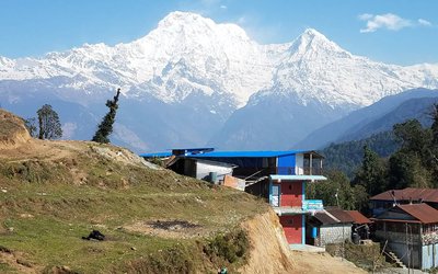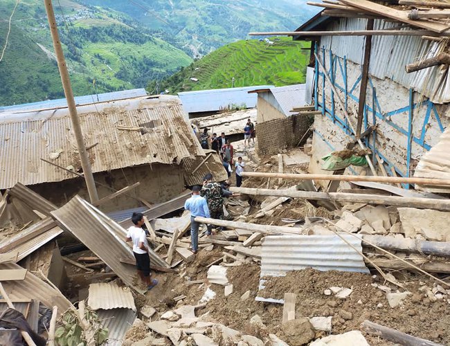
In the early morning of the 14th August2020, a sad news broke out from the northeast neighboring district of Kathmandu. Lidi, a beautiful village in Jugal Rural Municipality of Sindhupalchok District, was swept away by landslides triggered by the heavy monsoon rainfall. A total of39 people were killed or missing. Similar incidends followed in Bajura and Accham in the following week.
The tragedy happened despite the fact that those who lost their lives were aware of the risks. Several months ago, they had noticed cracks along the hill slopes and reported to the government agencies in the district as well as their headquarters in Kathmandu. Furthermore, a government-commissioned study following the Gorkha earthquake of 2015 had recommended for relocating the settlement considering the high risks related to geo-climatic hazards. Concerned over the imminent risks, representatives of Lidivillage had approached the National Reconstruction Authority and several other agencies to press for timely execution of the recommendation. But no action was taken – and the news of the disaster broke the silence.
This was one of a series of disasters that occurred following the monsoon cycle that started in the first week of June. Over 200 people have been killed across the country, along with damages of public and private property worth billions of Rupees. Landslides are among the top few hazards that pose permanent threats to the mountain residents in the Himalaya. Recent studies have reported that mapping villages vulnerable to extreme rainfalls and potential landslides is feasible with available resources and expertise. However, the number of human casualty and the extent of property lost this year have been surprisingly higher than the average losses in a normal monsoon such as this year. Why abnormal landslide disaster in the normal monsoon? This could be an uncomfortable question from the governance perspective as the analysis can expose the ineffective policy measures, corruption, and the lack of accountability.
Much to our dismay, the Lidi village disaster has exposed how non-responsive Nepal’s disaster preparedness is despite of improved weather tracking and forecasting infrastructures. Majority of landslides are triggered by prolonged monsoon rainfall or cloudbursts but remained unreported in absence of weather monitoring station. Tracking these incidents from historic database helps locating their frequencies and intensities, thus, identifying risk zones. Historically, these extreme rainfall incidents remained untracked and out of record in precipitation database partly due to manually operated rain-gauges that are observed once in 24 hours.
In recent years, the Department of Hydrology and Meteorology (DHM) has upgraded many of the manually operated rain gauges into automated one so that rainfall data of every hours are tracked and analysed. These new hourly rainfall data offer useful clues to locate the areas of cloudburst risks in the country, and, undertake preventive actions. On top of this, recently installed weather radar can be useful to monitor of heavy rainfall and issue impact-based weather warnings to the residents of the high-risk zones. Benefits of the improved forecasting and databases should be reflected in the actions of DRM agencies and media toward reducing geo-climate induced hazards including mapping, tracking and mitigating the disaster risks. These new technologies and knowledge towards preparing an erosivity map would be immensely useful to reducing the risks of disasters across the country. However, this facility remains unused in the disaster response planning and implementation.
The Lidi disaster has also exposed serious fault in our spatial planning. An assessment of risks associated with geo-climatic hazard of settlements along the highways shows that nearly all the settlements along the national and rural highways are new but totally unplanned (at least in statutory sense). These range from small market places to rapidly urbanizing towns. Incorporating a strategy of rapid assessments of geo-climatic hazards of these human settlements would not only save lives but also enhance the safety of the critical development infrastructures such as bridges and roads. Assessment of geo-climatic hazards involve analyses of major features of geology (nature of bedrocks, slope, orientation, old landslides characteristics), hydrology (watershed, proximity of river, streams or floodways, sediment deposits), and meteorology (extreme weather phenomena, distance of weather monitoring station, incidents of climate induced disasters). This should also include an assessment of community capacity to cope with the risks. Such assessment doesn’t cost high as junior engineers or trained technicians can collect the information, if given a training. They can also survey professional analyses to evaluate the risks of geo-climatic hazards and recommend appropriate measures for field actions. Combining such technical analysis with local wisdom of the community, especially the elderly people residing in the area, can yield important insights into area specific disaster risk management options.
What we find particularly surprising is that the Lidi village has been swept away by an ordinary monsoon following completion of the five-yearly reconstruction phase of disaster resilience. Following the 2015 earthquakes and other geo-climatic disasters that affected Lidi settlements, a significant amount of reconstruction work had sought to make villages disaster-resilient. The resilience building interventions expanded roads, constructed new bridges, created new cluster of houses and public facilities such as schools, health centres, market places and drainage systems. Ironically, these very resilience-enhancing activities appear to have escalated disaster risks. This is because these new infrastructures have altered the natural drainage pattern of the areas, particularly in the areas where large scale earth moving machineries (commonly known as “dozers”) are used without following a resilience protocol. Besides, questions have also arisen whether these new settlements and infrastructures were designed to withstand the 50 to 100 yearly cycles of cloudbursts or floods. Without reassessments of geo-climatic risks and risk integrated settlement planning, Nepal is headed to more frequent and severe landslides in its fragile mountains.
A key way forward is to strengthen municipality level geo-climatic hazard risks monitoring capacity. Currently, the local and provincial governments are in the process of strengthening their planning and monitoring divisions. Ensuring a socio-geological unit with expertise on geo-climatic hazard risk monitoring is critically important to augment science and voice of the vulnerable communities. Installation of automated weather monitoring station would be immensely useful to address the data gap.
To strengthen disaster risk management capacity, sustained efforts are needed to understand the dual edge nature of water induced disaster risks of ‘too much water’ causing flood (in the monsoon) and ‘too little’ water causing drought and agricultural failures (dry season). Multi-hazard risk assessment and comprehensive approach to building resilience are crucial. Experience from around the world shows that a suite of solutions exists to minimize the dual edge disaster risk of water (from rain water harvesting or management, spring conservation, watershed protection to local water markets). However, these solutions can work only when appropriate development planning and accountable governing mechanisms are operational at the community through local government to the federal levels.
Dr Dahal is climate analyst affiliated with Southasia Institute of Advanced Studies and Nepal Water Conservation Foundation. Email:ngamindra@gmail.com
Dr Ojha is associated with Southasia Institute of Advanced Studies (Nepal) and University of Canberra and the Institute for Studyy and Development Worldwide (Australia). Email: hemant.ojha@canberra.edu.au