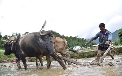
The Terai political agitation mainly centered around few local political parties' demand to isolate the Terai from the northern hills in drawing the provincial boundary lines might have easily come to an end if it would have been clearly explained to them that such an act would be extremely disastrous to the economy of almost the whole of Terai due to the fact that the Terai economy is entirely based on agriculture, which is going to be almost completely dependant on water supply from the mid hills.
Needless to say that apart from serious environmental degradation and loss of valuable agricultural lands the diversion of water into Terai for irrigation would result to significant reduction in hydropower potential of the hill region. It can easily be construed that the mountain province would never willingly agree to allow water diversion into Terai sacrificing the vital interest of the local hill people if it is detached from the Terai. Thus the Terai would be completely cut off from its water supply source, which is lifeline for the sustainability of its economy, if this region is detached from the mountain areas in fixing the provincial boundary.
Furthermore, a vast area of Eastern Terai is certain to be completely razed to the ground accompanied with enormous loss of life and property if mammoth storage dams are not built to control anticipated very big Kosi floods even though according to the World Commission on Dam study the storage reservoirs would be extremely harmful to the economy of the hill regions .
Why Terai Desperate for Water?
Most of the people in our country appear to be in complete ignorance of the terrible consequences for the Terai if it is detached from the hill regions in drawing the provincial boundary lines.
(1) There was a rampant deforestation in the past across the entire Terai region and its adjoining Churia area. This has led to gradual drying up of the local rivulets and streams that were traditionally the source of local irrigation. Contrary to it, area under cultivation has greatly increased due to deforestation, which has led to increase in demand for water needed to irrigate new lands.
(2) There is a rapid growth of population in the upper catchment areas of small and medium sized rivers also directly flowing into Terai from the hill areas. The flow of these rivers is being increasingly used in the hill region itself during the dry season with the result that the dry season flow of such rivers in Terai is constantly decreasing.
(3) Substantial withdrawal of ground water in future for irrigation in Bihar and UP that have deeper aquifer bottom would have adverse impact on ground water potential of our Terai. An example of such case is the Mississippi v. Memphis Ground Water Dispute in the USA. Mississippi state had blamed Tennessee for unlawfully withdrawing its ground water by forming deep cone of depression.
Complete Dependence of Terai on Water Supply from Remote Hills
Detailed studies of several large irrigation projects have already been conducted to recommend ways to fulfill the demand for water supply to irrigate on a large scale Terai lands by diverting water from rivers located far away in the mountain region. They are as follows:
Detailed irrigation development studies of all districts from Parsa to Saptari by diverting Sun-Kosi River were conducted with the help of UNDP/FAO; Similarly for Jhapa by diverting Kankai River(with the help of West German Govt. and ADB); For Rupandehi and Nawal Parasi by diverting Kali Gandaki river(with the help of UNDP); Kapilvastu by diverting West Rapti river (with the help of West German agency); Banke, Bardia, Kailali by ADB, JICA by diverting Bheri river along with irrigation water drawing directly from the Karnali storage dam project (with the help of ADB, JICA and World Bank). With the exception of irrigation in Jhapa and irrigation drawing water directly from the Karnali storage dam project, all other proposed schemes involve diversion of water from the mid hill by long tunneling across high mountains.
Irrigation Projects Disastrous to Hill People
The following is the excerpt from the World Commission on Dams Report published in 2000, which clearly helps us to come to the conclusion that contrary to assurance of our policy makers and planners the inhabitants of the mountain region would be greatly impoverished after the implementation of large water resources projects.
Dams take a set of resources – a river and the lands along the banks , generating food and livelihood for local people, transform them into another set of resources – a reservoir, hydropower and irrigation, providing benefits to people living elsewhere. There is a sense, therefore, in which large dams export rivers and lands, removing them from the productive domain of one community to make them available to another.
Devastation of Sunsari and Morang Districts
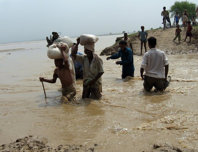
At present vast areas in Terai are frequently affected by devastating floods. The most serious is the Kosi flood problem. Resorting to provision of large storage dam projects in the catchment area is the only reliable solution to Terai flood problem in general and the Kosi flood problem in particular.
Kosi river channel bed is already well above the surrounding grounds due to continued siltation. The embankments have already outlived their useful life. We have witnessed enormous loss of life and property in 2008 breach of Kosi embankment when the flood discharge was only about 1 ½ lack cusecs, where-as extremely high flood discharge of almost nine lacks cusecs have already been measured twice within a short interval of 10 years some years ago when river bed siltation had just started. After that the flood discharge was mostly below 5 lacks cusecs
Well known experts on Kosi, like Sir Claude Inglis, Shillingfeld and many others, have predicted that the eastern embankment would be breached right away near Chatra. The Kosi would completely change its present course and would follow its original path about 70 miles to the east of the present course accompanied with enormous loss of life and property .
Provincial Boundary
Our Terai would be the real beneficiary of the large storage dam projects to be built in our mid hills. Apart from economic prosperity even the physical survival of a vast region of our Terai would be depending in future on large storage dam projects to be implemented in the mid hills at great sacrifices to be made by the hill people.
Separation of Terai from northern hill region in fixation of provincial boundaries would be tantamount to suicide for the people of Terai. Unfortunately our economic planners, policy makers, intelligentsia and media have never tried to explain about it to general public and in particular to Terai people.

Dr. A.B. Thapa
Thapa writes on water resources issue
- Dudhkosi Multipurpose Project
- Jul 11, 2022
- Dudh-Kosi Power Project And Kosi Treaty
- Sep 27, 2021
- Uttarakhand Glaciers And Recent Disaster: A Lesson To Our Country
- Mar 02, 2021
- Multipurpose Langtang After Melamchi: Inter-Basin Water Transfer
- Nov 04, 2020
- Large Storage Dams Projects Wary of Giving Away Children’s Inheritance
- Dec 22, 2019